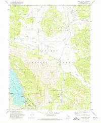
1972 Map of Crocker Mtn
USGS Topo · Published 1974About this map
Lake Davis dominates the southwestern corner of this Plumas County landscape, created following the construction of the Grizzly Valley Dam. The surrounding terrain of the Plumas National Forest is defined by high ridges like Crocker Mountain and the Coyote Hills, where drainage patterns flow through Long Canyon and Dotta Canyon. This 1970s survey illustrates a shift toward recreation and conservation, with established sites such as Grasshopper Flat Campground and Crocker Campground situated near the newer reservoir's shores.
Find a feature on this map
39 named features on this map. Tap any name to fly to it.
Don’t see what you’re looking for? This feature index may not catch every label — zoom into the map to look around manually.
Map Details
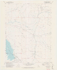
Editions of this 1972 Crocker Mtn Map
2 editions found
Other maps of this area

1886 · Honey Lake
USGS Topo · 1:250,000

1890 · Sierraville
USGS Topo · 1:125,000

1891 · Downieville
USGS Topo · 1:125,000

1891 · Honey Lake
USGS Topo · 1:250,000

1892 · Sierraville
USGS Topo · 1:125,000

1893 · Honey Lake
USGS Topo · 1:250,000

1893 · Downieville
USGS Topo · 1:125,000

1894 · Sierraville
USGS Topo · 1:125,000

1895 · Downieville
USGS Topo · 1:125,000

1896 · Downieville
USGS Topo · 1:125,000