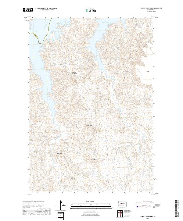
2021 Map of Crokett Mountains
USGS Topo · Published 2021About this map
Crockett Mountains and several prominent buttes dominate this landscape where the high plains meet the vast waters of Lake Oahe. The map documents a rugged section of the Missouri River valley along the boundary of Dewey and Stanley counties. This modern topographic record reveals the complex drainage patterns of the Sansarc Cr and the Minneconjou Cr systems, which have carved deep draws and ridges into the terrain. Notable landmarks such as Lindsay Butte, Black Butte, and Cedar Butte serve as distinct navigational points in an area otherwise defined by its natural topography. The sparse road network, featuring Minneconjou Rd and Link Rd, suggests a territory primarily used for ranching or conservation, maintaining the open character of the South Dakota prairie.
Find a feature on this map
17 named features on this map. Tap any name to fly to it.
Don’t see what you’re looking for? This feature index may not catch every label — zoom into the map to look around manually.
Map Details
Editions of this 2021 Crokett Mountains Map
This is the sole edition of this map. No revisions or reprints were ever made.
Other maps of this area

1954 · Pierre
USGS Topo · 1:250,000

1956 · Rousseau Creek SW
USGS Topo · 1:24,000

1956 · Herbert Creek SE
USGS Topo · 1:24,000

1956 · Sansarc NE
USGS Topo · 1:24,000

1956 · Crockett Mountains
USGS Topo · 1:24,000

1958 · Pierre
USGS Topo · 1:250,000

1969 · Rousseau Creek
USGS Topo · 1:24,000

1982 · Sansarc
USGS Topo · 1:24,000

1982 · Mission Ridge
USGS Topo · 1:24,000

1983 · Standing Butte
USGS Topo · 1:24,000