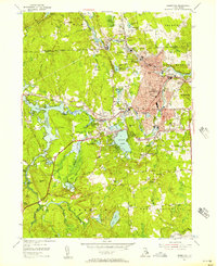
1955 Map of Crompton
USGS Topo · Published 1957About this map
The South Branch Pawtuxet River and its industrial corridor dominate the mid-1950s landscape of Kent County. The densely settled textile mill villages of West Warwick—including Arctic, Lippitt, and Crompton—cluster along the river's winding path, while the New York New Haven and Hartford railroad tracks weave through the valley to serve these manufacturing centers. To the west, the terrain transitions into a more rural character defined by significant water bodies and wetlands. The massive Flat River Reservoir and the expansive Mishnock Swamp reflect a landscape heavily influenced by hydrological management for downstream industry. Genealogists will find numerous family and parish burial grounds, such as Greenwood Cem and Notre Dame Cem, while the presence of the Coventry Air Park and modern school facilities like Deering High Sch mark the region's post-war expansion and civic maturation.
Find a feature on this map
107 named features on this map. Tap any name to fly to it.
Don’t see what you’re looking for? This feature index may not catch every label — zoom into the map to look around manually.
Map Details
Editions of this 1955 Crompton Map
3 editions found
Other maps of this area

1887 · Providence
USGS Topo · 1:62,500

1889 · Providence
USGS Topo · 1:62,500

1889 · Burrillville
USGS Topo · 1:62,500

1890 · Narragansett Bay
USGS Topo · 1:62,500

1890 · Kent
USGS Topo · 1:62,500

1892 · Narragansett Bay
USGS Topo · 1:62,500

1894 · Burrillville
USGS Topo · 1:62,500

1894 · Kent
USGS Topo · 1:62,500

1894 · Providence
USGS Topo · 1:62,500

1915 · Burrillville
USGS Topo · 1:62,500