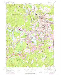
1955 Map of Crompton
USGS Topo · Published 1977About this map
The Pawtuxet River and its branches serve as the industrial and social spine of this Rhode Island landscape, connecting a dense string of mill villages including Arkwright, Phenix, Arctic, and Quidnick. The map documents a period of suburban transition, where historical textile settlements are linked by the Conrail line while newer developments begin to flank the Flat River Reservoir and Tiogue Lake.
Find a feature on this map
102 named features on this map. Tap any name to fly to it.
Don’t see what you’re looking for? This feature index may not catch every label — zoom into the map to look around manually.
Map Details
Editions of this 1955 Crompton Map
3 editions found
Other maps of this area

1887 · Providence
USGS Topo · 1:62,500

1889 · Providence
USGS Topo · 1:62,500

1889 · Burrillville
USGS Topo · 1:62,500

1890 · Narragansett Bay
USGS Topo · 1:62,500

1890 · Kent
USGS Topo · 1:62,500

1892 · Narragansett Bay
USGS Topo · 1:62,500

1894 · Burrillville
USGS Topo · 1:62,500

1894 · Kent
USGS Topo · 1:62,500

1894 · Providence
USGS Topo · 1:62,500

1915 · Burrillville
USGS Topo · 1:62,500