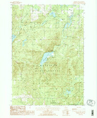
1986 Map of Crooked Lake
USGS Topo · Published 1986About this map
Briley State Forest and Mackinaw State Forest dominate this mid-1980s landscape in Montmorency County, characterized by a dense network of glacial lakes and northern woodlands. An Old RR Grade winds through the northwest, serving as a reminder of the region's historical timber industry and the specialized transport networks that once accessed these woods. Water is the defining feature of the area, from the larger Avery Lake and Lake Fifteen to the cluster of Bass Lakes and Sage Lakes.
Find a feature on this map
24 named features on this map. Tap any name to fly to it.
Don’t see what you’re looking for? This feature index may not catch every label — zoom into the map to look around manually.
Map Details
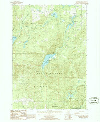
Editions of this 1986 Crooked Lake Map
2 editions found
Other maps of this area

1949 · Lewiston
USGS Topo · 1:62,500

1950 · Lewiston
USGS Topo · 1:24,000

1950 · Comstock Hills
USGS Topo · 1:24,000

1951 · Comstock Hills
USGS Topo · 1:24,000

1951 · Lewiston
USGS Topo · 1:24,000

1954 · Hetherton
USGS Topo · 1:62,500

1954 · Traverse City
USGS Topo · 1:250,000

1955 · Atlanta
USGS Topo · 1:62,500

1955 · Comins
USGS Topo · 1:62,500

1955 · Cheboygan
USGS Topo · 1:250,000