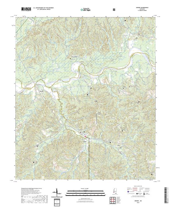
2024 Map of Crosby
USGS Topo · Published 2024About this map
The Homochitto River carves a winding path through the southwest corner of Mississippi, defining the landscape where the borders of Franklin, Amite, and Wilkinson counties converge. This modern study of the area centered on Crosby reveals a terrain heavily influenced by the Homochitto National Forest, which blankets much of the central and eastern portions of the quadrangle. The river’s historical importance as a transport artery is noted by the locations of Harvard Ferry and Wilsons Ferry, point markers of a time when river crossings were vital to local commerce.
Find a feature on this map
72 named features on this map. Tap any name to fly to it.
Don’t see what you’re looking for? This feature index may not catch every label — zoom into the map to look around manually.
Map Details
Editions of this 2024 Crosby Map
This is the sole edition of this map. No revisions or reprints were ever made.
Other maps of this area

1953 · Natchez
USGS Topo · 1:250,000

1956 · Natchez
USGS Topo · 1:250,000

1959 · Natchez
USGS Topo · 1:250,000

1961 · Liberty
USGS Topo · 1:62,500

1961 · Crosby
USGS Topo · 1:62,500

1961 · Gloster
USGS Topo · 1:62,500

1962 · Bude
USGS Topo · 1:62,500

1984 · McComb
USGS Topo · 1:100,000

1984 · Woodville
USGS Topo · 1:100,000
1988 · Homochitto
USGS Topo · 1:24,000