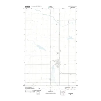
2011 Map of Crosby
USGS Topo · Published 2011About this map
Crosby serves as the primary hub of this northern plains landscape, situated just south of the Canadian border in Divide County. The town's grid is clearly defined by landmarks such as Central Ave and N Main St, showing a community organized around its transportation routes and agricultural service infrastructure. The local history and genealogy of the area are anchored by two significant burial grounds, Saint Patricks Cemetery to the north and Concordia Cemetery to the southeast. To the north, the Long Creek Dam provides water management for the surrounding prairie, while the Crosby Municipal Airport marks the town's modern connectivity. The map also captures a extensive network of rural roads, including 122nd Ave NW and County Rd 15, which delineate the section-line patterns typical of North Dakota's high plains ranching and farming country.
Find a feature on this map
32 named features on this map. Tap any name to fly to it.
Don’t see what you’re looking for? This feature index may not catch every label — zoom into the map to look around manually.
Map Details
Editions of this 2011 Crosby Map
This is the sole edition of this map. No revisions or reprints were ever made.
Other maps of this area

1948 · Crosby SW
USGS Topo · 1:24,000

1948 · Ambrose
USGS Topo · 1:24,000

1948 · Crosby
USGS Topo · 1:24,000

1948 · Crosby SE
USGS Topo · 1:24,000

1949 · Paulson
USGS Topo · 1:24,000

1949 · Noonan SW
USGS Topo · 1:24,000

1950 · Crosby
USGS Topo · 1:62,500

1950 · Noonan
USGS Topo · 1:62,500

1953 · Williston
USGS Topo · 1:250,000

1957 · Williston
USGS Topo · 1:250,000