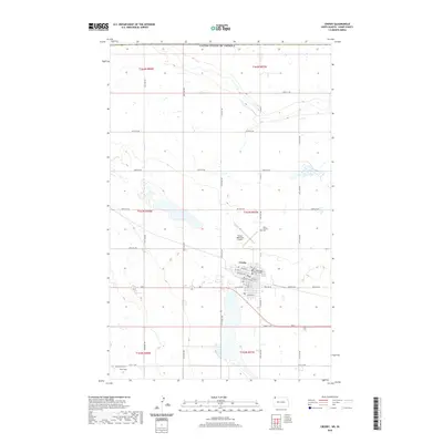
2020 Map of Crosby
USGS Topo · Published 2020About this map
Crosby serves as the focal point of this Divide County survey, positioned just south of the border between the United States of America and Canada. The town's grid is anchored by the Divide County Court House and organized around arterial streets like Central Ave and ND 5. The surrounding prairie landscape is marked by several small wetlands and scattered water bodies characteristic of the Northern Plains. Civic life is mapped through features such as the Crosby Municipal Airport to the north and Troy Field to the southwest. Genealogists will find the locations of Saint Patricks Cem and Concordia Cem clearly marked, offering a look at the community's established history in this borderland region.
Find a feature on this map
38 named features on this map. Tap any name to fly to it.
Don’t see what you’re looking for? This feature index may not catch every label — zoom into the map to look around manually.
Map Details
Editions of this 2020 Crosby Map
This is the sole edition of this map. No revisions or reprints were ever made.
Other maps of this area

1948 · Crosby SW
USGS Topo · 1:24,000

1948 · Ambrose
USGS Topo · 1:24,000

1948 · Crosby
USGS Topo · 1:24,000

1948 · Crosby SE
USGS Topo · 1:24,000

1949 · Paulson
USGS Topo · 1:24,000

1949 · Noonan SW
USGS Topo · 1:24,000

1950 · Crosby
USGS Topo · 1:62,500

1950 · Noonan
USGS Topo · 1:62,500

1953 · Williston
USGS Topo · 1:250,000

1957 · Williston
USGS Topo · 1:250,000