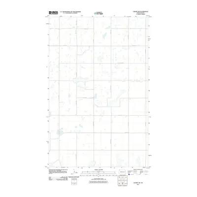
2011 Map of Crosby SW
USGS Topo · Published 2011About this map
The prairie landscape of Divide County at the start of the 2010s is defined by a rigid section-line grid and numerous glacial depressions. This survey by the U.S. Geological Survey reveals a sparsely populated terrain where the transportation network follows a strict cardinal alignment, dominated by routes such as 128th Ave NW and County Rd-12. The area is characterized by an extensive collection of small seasonal wetlands and sloughs scattered across the township lines, a classic feature of the northern plains. Settlement patterns here are tied to the local road system, including 100th St NW and 93rd St NW, which serve the agricultural plots of this remote corner of North Dakota. The map provides a detailed look at the rural infrastructure of the region just before significant changes in the western part of the state.
Find a feature on this map
13 named features on this map. Tap any name to fly to it.
Don’t see what you’re looking for? This feature index may not catch every label — zoom into the map to look around manually.
Map Details
Editions of this 2011 Crosby SW Map
This is the sole edition of this map. No revisions or reprints were ever made.
Other maps of this area

1948 · Smoky Butte
USGS Topo · 1:24,000

1948 · Alamo N.E.
USGS Topo · 1:24,000

1948 · Crosby SW
USGS Topo · 1:24,000

1948 · Ambrose
USGS Topo · 1:24,000

1948 · Bright Water Lake
USGS Topo · 1:24,000

1948 · Crosby
USGS Topo · 1:24,000

1948 · Crosby SE
USGS Topo · 1:24,000

1950 · Crosby
USGS Topo · 1:62,500

1953 · Williston
USGS Topo · 1:250,000

1957 · Williston
USGS Topo · 1:250,000