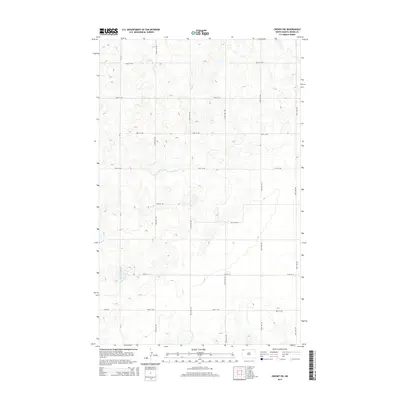
2014 Map of Crosby SW
USGS Topo · Published 2014About this map
Glacial depressions and prairie potholes characterize this corner of Divide County, North Dakota, in the early 21st century. The landscape is defined by a strictly organized section-line grid of rural routes, including the north-south artery of CR-11 and a network of gravel and local roads such as 128th Ave NW and 127th Ave NW. These roads follow the township and range lines, creating a geometric pattern across the undulating terrain. While the area is largely devoid of concentrated settlements, the infrastructure represented by roads like 100th St NW and 93rd St NW reveals the enduring importance of agricultural access in this high plains environment. The density of unnamed wetlands and small water bodies shown between the roads illustrates the complex local drainage of the Missouri Plateau.
Find a feature on this map
14 named features on this map. Tap any name to fly to it.
Don’t see what you’re looking for? This feature index may not catch every label — zoom into the map to look around manually.
Map Details
Editions of this 2014 Crosby SW Map
This is the sole edition of this map. No revisions or reprints were ever made.
Other maps of this area

1948 · Smoky Butte
USGS Topo · 1:24,000

1948 · Alamo N.E.
USGS Topo · 1:24,000

1948 · Crosby SW
USGS Topo · 1:24,000

1948 · Ambrose
USGS Topo · 1:24,000

1948 · Bright Water Lake
USGS Topo · 1:24,000

1948 · Crosby
USGS Topo · 1:24,000

1948 · Crosby SE
USGS Topo · 1:24,000

1950 · Crosby
USGS Topo · 1:62,500

1953 · Williston
USGS Topo · 1:250,000

1957 · Williston
USGS Topo · 1:250,000