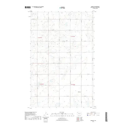
2017 Map of Crosby SW
USGS Topo · Published 2017About this map
Glacial depressions and small wetlands dot this rural corner of Divide County, North Dakota, where the landscape is organized by the Public Land Survey System. The township lines of t162n r99w, t162n r98w, t161n r99w, and t161n r98w meet near the center of the sheet, defining a region where the section-line road grid is remarkably consistent. Landmarks are few and concentrated at old community sites, such as Troy Cem and the Bethlehem Lutheran Cem. These small rural cemeteries remain as identifiers for earlier prairie settlements that once thrived along the county's gravel arteries. The primary transportation routes include Co Rd 14 and Co Rd 31, which connect isolated farmsteads across the northwestern North Dakota plains.
Find a feature on this map
24 named features on this map. Tap any name to fly to it.
Don’t see what you’re looking for? This feature index may not catch every label — zoom into the map to look around manually.
Map Details
Editions of this 2017 Crosby SW Map
This is the sole edition of this map. No revisions or reprints were ever made.
Other maps of this area

1948 · Smoky Butte
USGS Topo · 1:24,000

1948 · Alamo N.E.
USGS Topo · 1:24,000

1948 · Crosby SW
USGS Topo · 1:24,000

1948 · Ambrose
USGS Topo · 1:24,000

1948 · Bright Water Lake
USGS Topo · 1:24,000

1948 · Crosby
USGS Topo · 1:24,000

1948 · Crosby SE
USGS Topo · 1:24,000

1950 · Crosby
USGS Topo · 1:62,500

1953 · Williston
USGS Topo · 1:250,000

1957 · Williston
USGS Topo · 1:250,000