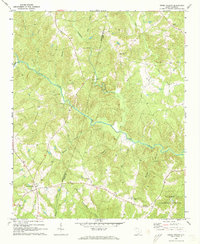
1969 Map of Cross Anchor
USGS Topo · Published 1973About this map
The Tyger River winds through this Piedmont landscape, defining the topography across the Spartanburg and Union county line. The 1969 field-checked survey reveals a rural territory transitioning into the southern reaches of the Sumter National Forest. The settlement of Cross Anchor serves as a local hub at the intersection of several secondary roads, while the community of Cross Keys anchors the southeastern corner of the map.
Find a feature on this map
34 named features on this map. Tap any name to fly to it.
Don’t see what you’re looking for? This feature index may not catch every label — zoom into the map to look around manually.
Map Details
Editions of this 1969 Cross Anchor Map
4 editions found

Other maps of this area

1941 · Spartanburg
USGS Topo · 1:250,000

1947 · Spartanburg
USGS Topo · 1:62,500

1949 · Spartanburg
USGS Topo · 1:62,500

1953 · Spartanburg
USGS Topo · 1:250,000

1960 · Spartanburg
USGS Topo · 1:250,000

1963 · Spartanburg
USGS Topo · 1:250,000

1964 · Spartanburg
USGS Topo · 1:250,000

1969 · Cross Anchor
USGS Topo · 1:24,000

1969 · Ora
USGS Topo · 1:24,000
1969 · Enoree
USGS Topo · 1:24,000