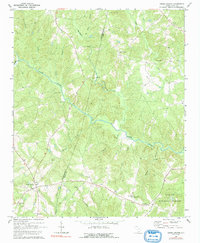
1969 Map of Cross Anchor
USGS Topo · Published 1991About this map
Cross Anchor and Cross Keys serve as the primary hubs in this region of the Piedmont during the late 1960s, a landscape defined by the deep winding path of the Tyger River. The area is densely patterned with rural institutional landmarks, particularly cemeteries and churches that mark long-standing community nodes. Genealogists may find value in the many burial grounds, such as New Hope Cem and Belmont Cem, while the local topography is intricately divided by numerous watercourses including Cane Creek, Dutchman Creek, and Mill Creek. The presence of the Sumter National Forest in the southeast corner indicates a transition into managed timberlands, though much of the map retains a classic rural South Carolina character of scattered farmsteads and narrow wooded bottoms along Elishas Creek and Cowdens Creek.
Find a feature on this map
29 named features on this map. Tap any name to fly to it.
Don’t see what you’re looking for? This feature index may not catch every label — zoom into the map to look around manually.
Map Details
Editions of this 1969 Cross Anchor Map
4 editions found

Other maps of this area

1941 · Spartanburg
USGS Topo · 1:250,000

1947 · Spartanburg
USGS Topo · 1:62,500

1949 · Spartanburg
USGS Topo · 1:62,500

1953 · Spartanburg
USGS Topo · 1:250,000

1960 · Spartanburg
USGS Topo · 1:250,000

1963 · Spartanburg
USGS Topo · 1:250,000

1964 · Spartanburg
USGS Topo · 1:250,000

1969 · Cross Anchor
USGS Topo · 1:24,000

1969 · Ora
USGS Topo · 1:24,000
1969 · Enoree
USGS Topo · 1:24,000