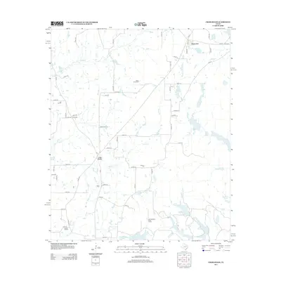
2012 Map of Cross Roads
USGS Topo · Published 2012About this map
Cross Roads and the surrounding Henderson County countryside are defined by a dense network of creeks and small, privately named lakes in this 2012 survey. The landscape is dominated by the drainage systems of Wildcat Cr, Prairie Cr, and Barron Cr, which feed numerous water bodies such as McElvaney Lake, Nichols Lake, and the larger Gator Lake to the south. Local history is anchored by several rural burial grounds, including Willow Springs Cem, Post Oak Cem, and Patterson Cem, marking long-established family and community ties. Economic activity is represented by the Cayuga Oil Field in the southwest and the Deer Meadow Ranch Airport. The settlement of Shady Oaks sits near the northern boundary, connected to the rest of the quadrangle by Farm to Market Roads 59 and 2970.
Find a feature on this map
77 named features on this map. Tap any name to fly to it.
Don’t see what you’re looking for? This feature index may not catch every label — zoom into the map to look around manually.
Map Details
Editions of this 2012 Cross Roads Map
This is the sole edition of this map. No revisions or reprints were ever made.
Other maps of this area

1949 · Athens
USGS Topo · 1:62,500

1949 · Tennessee Colony
USGS Topo · 1:62,500

1950 · Athens
USGS Topo · 1:62,500

1950 · Tennessee Colony
USGS Topo · 1:62,500

1953 · Palestine
USGS Topo · 1:250,000

1954 · Dallas
USGS Topo · 1:250,000

1954 · Waco
USGS Topo · 1:250,000

1955 · Waco
USGS Topo · 1:250,000

1956 · Tyler
USGS Topo · 1:250,000

1957 · Palestine
USGS Topo · 1:250,000