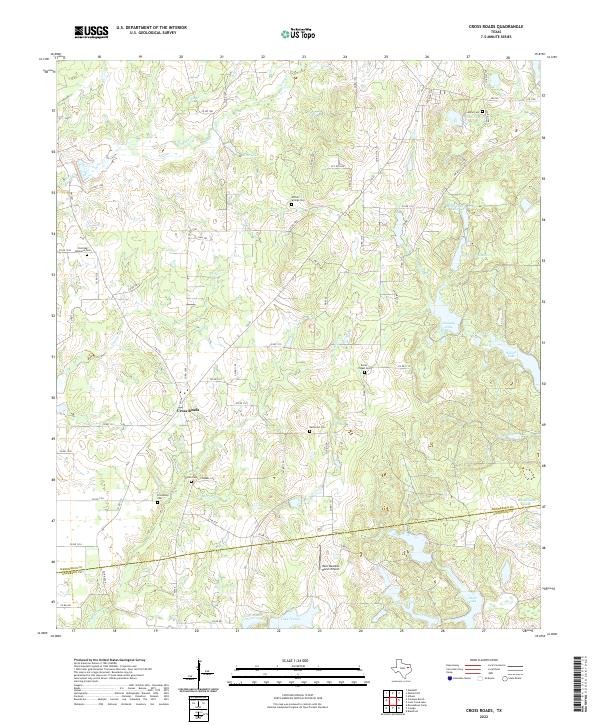
2022 Map of Cross Roads
USGS Topo · Published 2022About this map
Cross Roads serves as the focal point of this East Texas landscape, situated near the boundary between Henderson and Anderson Counties. The area is characterized by a high density of small, private lakes and family-named water bodies including McElvaney Lake, Perryman Lake, and Jonsson Lake. These impoundments are fed by local drainages like Prairie Cr and Anding Br, illustrating a transition from traditional agricultural land use to a landscape of managed water resources and rural residential development.
Find a feature on this map
73 named features on this map. Tap any name to fly to it.
Don’t see what you’re looking for? This feature index may not catch every label — zoom into the map to look around manually.
Map Details
Editions of this 2022 Cross Roads Map
This is the sole edition of this map. No revisions or reprints were ever made.
Other maps of this area

1949 · Athens
USGS Topo · 1:62,500

1949 · Tennessee Colony
USGS Topo · 1:62,500

1950 · Athens
USGS Topo · 1:62,500

1950 · Tennessee Colony
USGS Topo · 1:62,500

1953 · Palestine
USGS Topo · 1:250,000

1954 · Dallas
USGS Topo · 1:250,000

1954 · Waco
USGS Topo · 1:250,000

1955 · Waco
USGS Topo · 1:250,000

1956 · Tyler
USGS Topo · 1:250,000

1957 · Palestine
USGS Topo · 1:250,000