
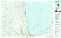
1984 Map of Croswell
USGS Topo · Published 1985About this map
The waters of Lake Huron define the eastern edge of this Michigan landscape, where the international boundary with Ontario sits just offshore. Inland, the topography is shaped by an extensive network of managed watercourses such as the Custer County Drain and Nicol Drain, which support the agricultural character of the region around Sandusky and Croswell. The Black River and Mill Creek cut through the southern portion of the map, leading toward the northern outskirts of Port Huron. This era shows a transition in transportation, with the Chesapeake rail line and the And Ohio route traversing the county alongside smaller rural facilities like the Talkaberry Landing Strip and Arnold Landing Field. Significant recreational and conservation spaces are established along the coast at Lakeport State Park and further south within the Port Huron State Game Area.
Find a feature on this map
150 named features on this map. Tap any name to fly to it.
Don’t see what you’re looking for? This feature index may not catch every label — zoom into the map to look around manually.
Map Details
Editions of this 1984 Croswell Map
2 editions found
Other maps of this area

1912 · Port Huron
USGS Topo · 1:62,500

1914 · Armada
USGS Topo · 1:62,500

1928 · Armada
USGS Topo · 1:62,500

1928 · Hicky
USGS Topo · 1:62,500

1929 · Port Huron
USGS Topo · 1:62,500

1939 · Port Huron
USGS Topo · 1:24,000

1939 · Smiths Creek
USGS Topo · 1:24,000

1939 · Goodells
USGS Topo · 1:24,000

1944 · Memphis
USGS Topo · 1:24,000

1945 · Almont
USGS Topo · 1:24,000