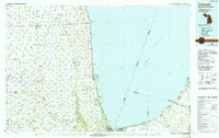
1984 Map of Croswell
USGS Topo · Published 1991About this map
Lake Huron defines the eastern edge of this Michigan-Ontario border region, where the shoreline is dotted with small lakefront communities like Blue Water Beach and Huronia Heights. The landscape is structured by a grid of townships, including Bridgehampton TP and Flynn TP, supporting a dense network of inland agricultural settlements. Farmland is broken by the forested corridors of the Port Huron State Game Area and the winding paths of the Black River and Cass River. Aviation history is visible through the presence of the Sandusky Municipal Airport and private airstrips like the Bebensee Landing Strip. Along the northern edge, the Old Moore Railroad provides a record of early transportation lines that helped develop Sanilac County before the modern highway system took precedence. The map also captures the international boundary within the lake, extending toward Kettle Point on the Canadian shore.
Find a feature on this map
105 named features on this map. Tap any name to fly to it.
Don’t see what you’re looking for? This feature index may not catch every label — zoom into the map to look around manually.
Map Details
Editions of this 1984 Croswell Map
2 editions found

Other maps of this area

1912 · Port Huron
USGS Topo · 1:62,500

1914 · Armada
USGS Topo · 1:62,500

1928 · Armada
USGS Topo · 1:62,500

1928 · Hicky
USGS Topo · 1:62,500

1929 · Port Huron
USGS Topo · 1:62,500

1939 · Port Huron
USGS Topo · 1:24,000

1939 · Smiths Creek
USGS Topo · 1:24,000

1939 · Goodells
USGS Topo · 1:24,000

1944 · Memphis
USGS Topo · 1:24,000

1945 · Almont
USGS Topo · 1:24,000