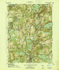
1944 Map of Croton Falls
USGS Topo · Published 1944About this map
Croton Falls Reservoir and its surrounding watershed dominate this mid-century landscape where the Muscoot River and both branches of the Croton River feed a complex network of public water supplies. The New York Central railroad provides the industrial spine for the region, connecting established rail towns like Katonah, Goldens Bridge, and Purdy. Local institutions such as the Somers Central Sch and the Pinewood Sanitarium reflect the area's development into a suburban and institutional corridor for Westchester and Putnam counties. For genealogists and local historians, the inclusion of sites like Wandell Cem, Mt Zion Ch, and the Reformatory near Lincolndale offers specific points for tracing family history and civic growth during the war years.
Find a feature on this map
51 named features on this map. Tap any name to fly to it.
Don’t see what you’re looking for? This feature index may not catch every label — zoom into the map to look around manually.
Map Details
Editions of this 1944 Croton Falls Map
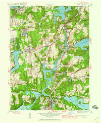
2 editions found
Other maps of this area

1892 · Stamford
USGS Topo · 1:62,500

1892 · West Point
USGS Topo · 1:62,500

1892 · Carmel
USGS Topo · 1:62,500

1892 · Tarrytown
USGS Topo · 1:62,500

1893 · Carmel
USGS Topo · 1:62,500

1893 · Stamford
USGS Topo · 1:62,500

1893 · Tarrytown
USGS Topo · 1:62,500

1894 · West Point
USGS Topo · 1:62,500

1894 · Carmel
USGS Topo · 1:62,500

1899 · Stamford
USGS Topo · 1:62,500