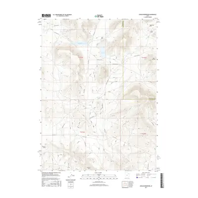
2017 Map of Crouse Reservoir
USGS Topo · Published 2017About this map
Crouse Reservoir and the nearby Zelph Calder Reservoir serve as central landmarks in this high-altitude landscape along the Uintah and Daggett County line. The terrain is defined by a series of significant drainages and elevations, including the prominent peak of Hoy Mountain and several deeply cut topographic features like Mail Draw, Dead Horse Draw, and Allen Draw.
Find a feature on this map
29 named features on this map. Tap any name to fly to it.
Don’t see what you’re looking for? This feature index may not catch every label — zoom into the map to look around manually.
Map Details
Editions of this 2017 Crouse Reservoir Map
This is the sole edition of this map. No revisions or reprints were ever made.
Other maps of this area

1885 · Ashley
USGS Topo · 1:250,000

1950 · Blair Basin
USGS Topo · 1:24,000

1952 · Warren Draw
USGS Topo · 1:24,000

1952 · Swallow Canyon
USGS Topo · 1:24,000

1954 · Vernal
USGS Topo · 1:250,000

1955 · Island Park
USGS Topo · 1:24,000

1955 · Jones Hole
USGS Topo · 1:24,000

1958 · Vernal
USGS Topo · 1:250,000

1960 · Vernal
USGS Topo · 1:250,000
1966 · Jensen Ridge
USGS Topo · 1:24,000