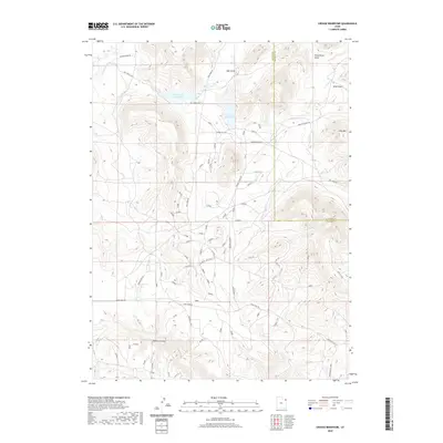
2020 Map of Crouse Reservoir
USGS Topo · Published 2020About this map
Crouse Reservoir and Zelph Calder Reservoir serve as the primary hydrologic anchors in this arid basin along the border of Uintah and Daggett counties. This 2020 survey illustrates a landscape defined by water management and ranching access, where water moves through the Calder Ditch and feeds into Pot Cr. The high-elevation terrain of Hoy Mtn overlooks a network of namesake ranching routes, including Walker Ranch Rd, Cook Ranch Rd, and the O'Brien Ranch Loop. These roads, along with the Crouse Canyon Rd, follow the natural contours of deep drainage features like Mail Draw and Allen Draw. The map documents a sparsely populated but highly organized system of backcountry transport and water infrastructure, essential for land use in this corner of Northeast Utah.
Find a feature on this map
25 named features on this map. Tap any name to fly to it.
Don’t see what you’re looking for? This feature index may not catch every label — zoom into the map to look around manually.
Map Details
Editions of this 2020 Crouse Reservoir Map
This is the sole edition of this map. No revisions or reprints were ever made.
Other maps of this area

1885 · Ashley
USGS Topo · 1:250,000

1950 · Blair Basin
USGS Topo · 1:24,000

1952 · Warren Draw
USGS Topo · 1:24,000

1952 · Swallow Canyon
USGS Topo · 1:24,000

1954 · Vernal
USGS Topo · 1:250,000

1955 · Island Park
USGS Topo · 1:24,000

1955 · Jones Hole
USGS Topo · 1:24,000

1958 · Vernal
USGS Topo · 1:250,000

1960 · Vernal
USGS Topo · 1:250,000
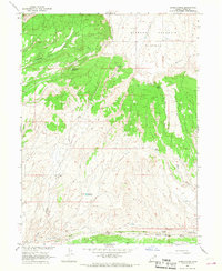
1966 · Jensen Ridge
USGS Topo · 1:24,000