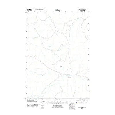
2011 Map of Crow Agency SE
USGS Topo · Published 2011About this map
Reno Ford and the winding course of Reno Creek define this landscape within the Crow Indian Reservation during the early twenty-first century. The terrain is shaped by a complex system of seasonal drainages, including Medicine Tail Creek and the North Fork Reno Creek, which flow through the open country of Big Horn County. Evidence of local water management and agricultural infrastructure is visible through features such as the Crow Number 60 Dam and the D S Scott Number 3 Dam. The map provides a clear view of the rural road network and topographic relief in this part of Montana, highlighting the traditional named crossings and waterways that have long served as landmarks for residents and travelers in the region north of the Little Bighorn battlefield area.
Find a feature on this map
9 named features on this map. Tap any name to fly to it.
Don’t see what you’re looking for? This feature index may not catch every label — zoom into the map to look around manually.
Map Details
Editions of this 2011 Crow Agency SE Map
This is the sole edition of this map. No revisions or reprints were ever made.
Other maps of this area

1894 · Rosebud
USGS Topo · 1:125,000

1901 · Rosebud
USGS Topo · 1:125,000

1954 · Hardin
USGS Topo · 1:250,000

1957 · Hardin
USGS Topo · 1:250,000

1958 · Hardin
USGS Topo · 1:250,000

1967 · Jeans Fork NW
USGS Topo · 1:24,000

1967 · Crow Agency NE
USGS Topo · 1:24,000

1967 · Crow Agency SE
USGS Topo · 1:24,000

1967 · Lodge Grass NE
USGS Topo · 1:24,000
1967 · Benteen
USGS Topo · 1:24,000