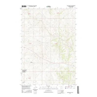
2017 Map of Crow Agency SE
USGS Topo · Published 2017About this map
The Little Bighorn Battlefield National Monument occupies a significant portion of this landscape, marking the site of one of the most studied military engagements in the American West. The geography here is defined by high ridges and deep drainages, including Medicine Tail Coulee and Medicine Tail Cr, which lead toward the larger Little Bighorn Valley. These terrain features were critical to the movement and tactics of both the Seventh Cavalry and the Lakota, Northern Cheyenne, and Arapaho forces. The map details the hydrology of the area, tracing the courses of Reno Cr and its N Fork Reno Cr, along with Custer Cr and Ash Cr. This layout provides an essential perspective on how the physical environment dictated historical events in Big Horn County, Montana.
Find a feature on this map
9 named features on this map. Tap any name to fly to it.
Don’t see what you’re looking for? This feature index may not catch every label — zoom into the map to look around manually.
Map Details
Editions of this 2017 Crow Agency SE Map
This is the sole edition of this map. No revisions or reprints were ever made.
Other maps of this area

1894 · Rosebud
USGS Topo · 1:125,000

1901 · Rosebud
USGS Topo · 1:125,000

1954 · Hardin
USGS Topo · 1:250,000

1957 · Hardin
USGS Topo · 1:250,000

1958 · Hardin
USGS Topo · 1:250,000

1967 · Jeans Fork NW
USGS Topo · 1:24,000

1967 · Crow Agency NE
USGS Topo · 1:24,000

1967 · Crow Agency SE
USGS Topo · 1:24,000

1967 · Lodge Grass NE
USGS Topo · 1:24,000
1967 · Benteen
USGS Topo · 1:24,000