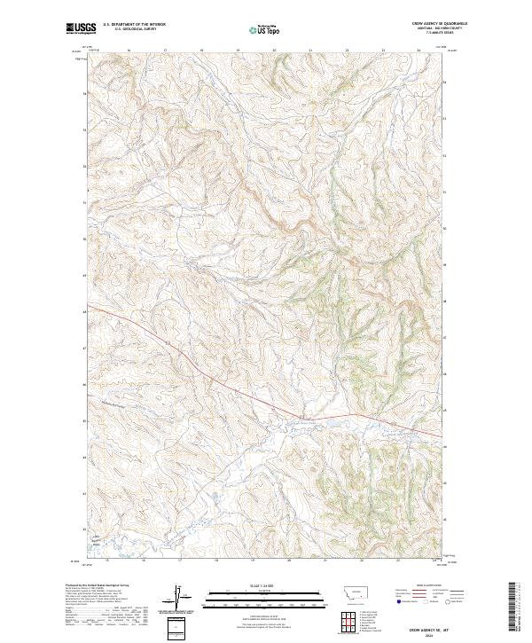
2024 Map of Crow Agency SE
USGS Topo · Published 2024About this map
The Little Bighorn Battlefield National Monument anchors the southwest corner of this Montana landscape, preserving a terrain defined by the deeply eroded drainage systems of the Little Bighorn Valley. This 2024 survey detail reveals the intricate topography of the Big Horn County uplands, where intermittent waterways like Medicine Tail Creek and Custer Creek have carved a series of complex coulees and ridges. The map illustrates the geographical context of historical events through named features such as Medicine Tail Coulee and North Fork Reno Creek. The landscape transition from the high, dissected divides near Ash Creek down toward the valley floor demonstrates the challenging natural obstacles and observational vantages that characterized the regional movement in the late nineteenth century.
Find a feature on this map
15 named features on this map. Tap any name to fly to it.
Don’t see what you’re looking for? This feature index may not catch every label — zoom into the map to look around manually.
Map Details
Editions of this 2024 Crow Agency SE Map
This is the sole edition of this map. No revisions or reprints were ever made.
Other maps of this area

1894 · Rosebud
USGS Topo · 1:125,000

1901 · Rosebud
USGS Topo · 1:125,000

1954 · Hardin
USGS Topo · 1:250,000

1957 · Hardin
USGS Topo · 1:250,000

1958 · Hardin
USGS Topo · 1:250,000

1967 · Jeans Fork NW
USGS Topo · 1:24,000

1967 · Crow Agency NE
USGS Topo · 1:24,000

1967 · Crow Agency SE
USGS Topo · 1:24,000

1967 · Lodge Grass NE
USGS Topo · 1:24,000
1967 · Benteen
USGS Topo · 1:24,000