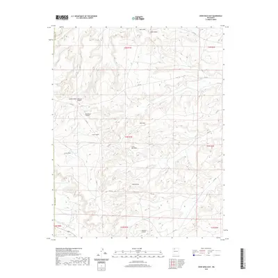
2020 Map of Crow Mesa East
USGS Topo · Published 2020About this map
Crow Mesa and the expansive drainage of Rincon Largo anchor this landscape in northwestern New Mexico, where the high desert terrain is defined by an intricate network of mesas and deep canyons. The map documents the complex topography of the San Juan Basin, marked by prominent landforms such as Blue Mesa, Little Blue Mesa, and the high elevation of Black Ridge. Water, though sparse, has shaped the region's geography through ephemeral channels like Palluche Wash and Blanco Wash, which cut through canyons including Rockhouse Canyon and Crow Canyon.
Find a feature on this map
29 named features on this map. Tap any name to fly to it.
Don’t see what you’re looking for? This feature index may not catch every label — zoom into the map to look around manually.
Map Details
Editions of this 2020 Crow Mesa East Map
This is the sole edition of this map. No revisions or reprints were ever made.
Other maps of this area

1889 · Largo
USGS Topo · 1:250,000

1895 · Largo
USGS Topo · 1:250,000

1954 · Aztec
USGS Topo · 1:250,000

1958 · Aztec
USGS Topo · 1:250,000

1959 · Nageezi
USGS Topo · 1:62,500

1962 · Aztec
USGS Topo · 1:250,000

1963 · Tayfoya Canyon
USGS Topo · 1:24,000

1963 · Gonzales Mesa
USGS Topo · 1:24,000

1965 · Aztec
USGS Topo · 1:250,000

1966 · Lybrook NW
USGS Topo · 1:24,000