
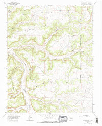
1963 Map of Gonzales Mesa
USGS Topo · Published 1965About this map
Jicarilla Apache Indian Reservation lands dominate the eastern boundary of this high-desert plateau, where the landscape is defined by the massive drainage systems of Cañon Largo. The 1963 survey captures a transition in land use, showing traditional homesteads like Kaime Ranch and Williams Ranch alongside the industrial footprint of a modern Pipeline network and the Dogle Canyon Pumping Station. High-elevation landmarks such as Ensenada Mesa and Gonzales Mesa rise between deep cuts like Julian Canyon and Albert Canyon. Water sources remain vital to the geography of this arid Rio Arriba region, with Albert Lake, Gonzales Spring, and Forbes Spring serving as key markers for local movement. The presence of numerous gas wells throughout the Lapis Valley and surrounding mesas illustrates the era's expanding energy infrastructure within the San Juan Basin.
Find a feature on this map
27 named features on this map. Tap any name to fly to it.
Don’t see what you’re looking for? This feature index may not catch every label — zoom into the map to look around manually.
Map Details
Editions of this 1963 Gonzales Mesa Map
2 editions found
Other maps of this area

1889 · Largo
USGS Topo · 1:250,000

1895 · Largo
USGS Topo · 1:250,000

1954 · Aztec
USGS Topo · 1:250,000

1958 · Aztec
USGS Topo · 1:250,000

1959 · Gould Pass
USGS Topo · 1:62,500

1959 · Nageezi
USGS Topo · 1:62,500

1962 · Aztec
USGS Topo · 1:250,000

1963 · Lapis Point
USGS Topo · 1:24,000

1963 · Tayfoya Canyon
USGS Topo · 1:24,000

1963 · Otero Store
USGS Topo · 1:24,000