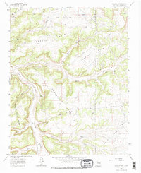
1963 Map of Gonzales Mesa
USGS Topo · Published 1978About this map
Jicarilla Apache Indian Reservation lands dominate the eastern portion of this Rio Arriba County landscape, where the plateau surface is deeply dissected by drainage systems like Tapicito Creek. The map documents a rugged high-desert environment defined by massive formations such as Gonzales Mesa and Ensenada Mesa, separated by the broad winding path of Cañon Largo.
Find a feature on this map
35 named features on this map. Tap any name to fly to it.
Don’t see what you’re looking for? This feature index may not catch every label — zoom into the map to look around manually.
Map Details
Editions of this 1963 Gonzales Mesa Map
2 editions found
Other maps of this area

1889 · Largo
USGS Topo · 1:250,000

1895 · Largo
USGS Topo · 1:250,000

1954 · Aztec
USGS Topo · 1:250,000

1958 · Aztec
USGS Topo · 1:250,000

1959 · Gould Pass
USGS Topo · 1:62,500

1959 · Nageezi
USGS Topo · 1:62,500

1962 · Aztec
USGS Topo · 1:250,000

1963 · Lapis Point
USGS Topo · 1:24,000

1963 · Tayfoya Canyon
USGS Topo · 1:24,000

1963 · Gonzales Mesa
USGS Topo · 1:24,000