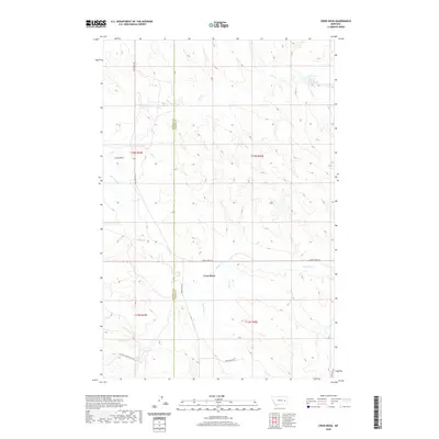
2020 Map of Crow Rock
USGS Topo · Published 2020About this map
Crow Rock serves as the focal point of this Eastern Montana landscape, situated near the boundary where Garfield and Prairie counties meet. The area is defined by a dendritic drainage network, with several waterways including Ash Creek, Crow Rock Creek, and Whites Creek carving through the terrain. These natural features dictated the early transportation routes, as seen in the placement of Crow Rock Road and Cherry Creek Road, which follow the contours of the land rather than a strict grid.
Find a feature on this map
17 named features on this map. Tap any name to fly to it.
Don’t see what you’re looking for? This feature index may not catch every label — zoom into the map to look around manually.
Map Details
Editions of this 2020 Crow Rock Map
This is the sole edition of this map. No revisions or reprints were ever made.
Other maps of this area

1953 · Miles City
USGS Topo · 1:250,000

1954 · Jordan
USGS Topo · 1:250,000

1954 · Forsyth
USGS Topo · 1:250,000

1954 · Glendive
USGS Topo · 1:250,000

1956 · Jordan
USGS Topo · 1:250,000

1957 · Miles City
USGS Topo · 1:250,000

1957 · Glendive
USGS Topo · 1:250,000

1957 · Forsyth
USGS Topo · 1:250,000

1958 · Miles City
USGS Topo · 1:250,000

1958 · Jordan
USGS Topo · 1:250,000