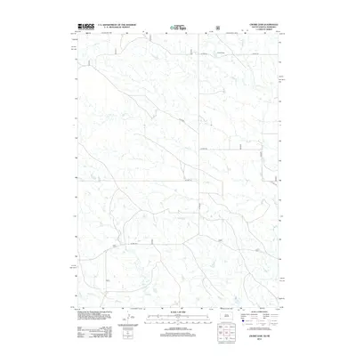
2012 Map of Crowe Dam
USGS Topo · Published 2012About this map
Crowe Dam and the surrounding drainage basins of the Nebraska and South Dakota borderlands define this topographic study. The landscape is characterized by a dendritic network of seasonal waterways, including Indian Cr in the south and Crow Cr further north, which carve through the high plains terrain. This 2012 survey illustrates the sparse, grid-based road network essential for ranching and land management in the region, featuring routes such as Co Hwy 7a and Co Rd 6412. The distribution of water features like Coal Cr and Duck Cr highlights the critical importance of surface water management in this arid environment, where small dams and creek beds serve as the primary landmarks across the rolling acreage of Bowen Precinct.
Find a feature on this map
11 named features on this map. Tap any name to fly to it.
Don’t see what you’re looking for? This feature index may not catch every label — zoom into the map to look around manually.
Map Details
Editions of this 2012 Crowe Dam Map
This is the sole edition of this map. No revisions or reprints were ever made.
Other maps of this area

1902 · Edgemont
USGS Topo · 1:125,000

1950 · Rumford
USGS Topo · 1:24,000

1955 · Hot Springs
USGS Topo · 1:250,000

1955 · Alliance
USGS Topo · 1:250,000

1957 · Alliance
USGS Topo · 1:250,000

1958 · Alliance
USGS Topo · 1:250,000

1980 · Montrose
USGS Topo · 1:24,000
1980 · Story
USGS Topo · 1:24,000
1980 · Story NE
USGS Topo · 1:24,000
1982 · Crowe Dam
USGS Topo · 1:25,000