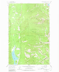
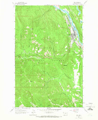
1963 Map of Crowell Mountain
USGS Topo · Published 1980About this map
Bull Lake anchors the western edge of this landscape, its shoreline featuring Callows Island and the Dorr Skeels Campground. In the early 1960s, this region of Lincoln County was defined by the intersection of the Kootenai National Forest and the Kaniksu National Forest, dominated by the steep rises of the Cabinet Mountains Wilderness. High peaks such as Crowell Mountain, Doonan Peak, and Gordan Mountain overlook a complex network of drainages including Lake Creek, Stanley Creek, and Crowell Creek. The map documents the indefinite Wilderness Boundary during a period of transition in forest management and conservation, where established campgrounds met the untracked high country of the Kootenai peaks and the Upper Cedar Lake basin.
Find a feature on this map
31 named features on this map. Tap any name to fly to it.
Don’t see what you’re looking for? This feature index may not catch every label — zoom into the map to look around manually.
Map Details
Editions of this 1963 Crowell Mountain Map
3 editions found
Other maps of this area

1920 · Libby
USGS Topo · 1:125,000

1930 · Libby
USGS Topo · 1:125,000

1932 · Libby
USGS Topo · 1:125,000

1957 · Kalispell
USGS Topo · 1:250,000

1960 · Kalispell
USGS Topo · 1:250,000

1961 · Kalispell
USGS Topo · 1:250,000

1963 · Scenery Mountain
USGS Topo · 1:24,000
1963 · Spar Lake
USGS Topo · 1:24,000
1963 · Troy
USGS Topo · 1:24,000

1963 · Treasure Mountain
USGS Topo · 1:24,000