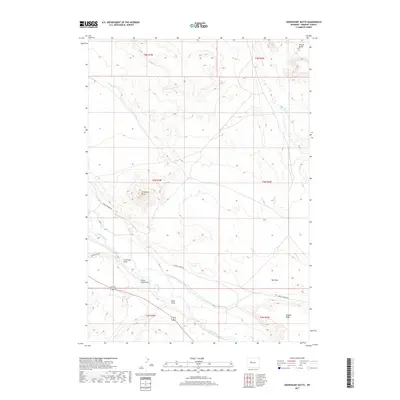
2017 Map of Crowheart Butte
USGS Topo · Published 2017About this map
Crowheart Butte stands as the central landmark of this high-desert landscape in Fremont County, overlooking the broad path of the Wind River. The terrain is defined by a network of drainage channels including Cleveland Draw, Little Sand Draw, and Ega Draw, which carve through the land toward the river basin. To the northeast, the distinct profile of Teapot Butte rises near Dry Cr, while the southern portion of the map is framed by the rising elevations of Stagner Ridge. Human presence in this area is marked primarily by the transport routes of Burris-Lenore Rd and Crowheart Dr, which follow the natural contours of the valley floor. The map illustrates the sparsely populated, open range character of the region, where the primary infrastructure consists of surveyed township and range lines and small local roads connecting the river corridor to the surrounding ridges.
Find a feature on this map
17 named features on this map. Tap any name to fly to it.
Don’t see what you’re looking for? This feature index may not catch every label — zoom into the map to look around manually.
Map Details
Editions of this 2017 Crowheart Butte Map
This is the sole edition of this map. No revisions or reprints were ever made.
Other maps of this area

1951 · Lookout Butte SW
USGS Topo · 1:24,000

1951 · Bull Lake East
USGS Topo · 1:24,000

1951 · Argo Butte
USGS Topo · 1:24,000

1951 · Maverick Spring
USGS Topo · 1:24,000

1952 · Crowheart Butte
USGS Topo · 1:24,000

1952 · Crowheart NW
USGS Topo · 1:24,000

1952 · Crowheart NE
USGS Topo · 1:24,000

1952 · Bull Lake West
USGS Topo · 1:24,000

1952 · Crowheart
USGS Topo · 1:24,000

1955 · Thermopolis
USGS Topo · 1:250,000