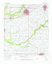
1955 Map of Crowley
USGS Topo · Published 1976About this map
Crowley and Rayne anchor this mid-century survey of the Acadia Parish prairie, where the Southern Pacific railroad corridor defined the growth of local rice-farming communities. Outside these urban centers, the landscape is a network of irrigation canals and bayous, including Bayou Plaquemine Brule and Bayou Queue de Tortue. The map documents the region's agricultural and educational infrastructure through the Louisiana State University Experiment Station and the Ross High Sch. Smaller settlements like Estherwood, Midland, and Ebenezer are clearly detailed, alongside rural landmarks such as the Estherwood Ferry and Simon Bridge. For those researching family history, numerous burial grounds are recorded, including Woodlawn Cem, Mire Cem, and Cossinade Cem, providing a precise look at the parish before later modern expansion.
Find a feature on this map
46 named features on this map. Tap any name to fly to it.
Don’t see what you’re looking for? This feature index may not catch every label — zoom into the map to look around manually.
Map Details
Editions of this 1955 Crowley Map
4 editions found
Other maps of this area

1932 · Abbeville NW
USGS Topo · 1:31,680

1934 · Duson
USGS Topo · 1:31,680

1935 · Branch
USGS Topo · 1:31,680

1946 · Morse
USGS Topo · 1:31,680

1946 · Leroy
USGS Topo · 1:31,680

1946 · Schooner Bayou NE
USGS Topo · 1:31,680

1946 · Schooner Bayou NW
USGS Topo · 1:31,680

1946 · Mermentau
USGS Topo · 1:31,680

1946 · Kaplan
USGS Topo · 1:31,680

1946 · Rayne
USGS Topo · 1:31,680