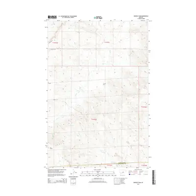
2014 Map of Crowley Dam
USGS Topo · Published 2014About this map
Crowley Dam and the surrounding drainage network of the central Montana plains define this landscape at the border of Petroleum and Musselshell counties. The terrain is characterized by a series of deep coulees and seasonal watercourses, including the wide Howard Coulee and Jim Coulee in the southern portion of the quadrangle. These geological features are complemented by the meandering paths of Flatwillow Cr, Alkali Cr, and Howard Cr, which dictate the local topography.
Find a feature on this map
19 named features on this map. Tap any name to fly to it.
Don’t see what you’re looking for? This feature index may not catch every label — zoom into the map to look around manually.
Map Details
Editions of this 2014 Crowley Dam Map
This is the sole edition of this map. No revisions or reprints were ever made.
Other maps of this area

1954 · Roundup
USGS Topo · 1:250,000

1958 · Roundup
USGS Topo · 1:250,000

1963 · Kelley
USGS Topo · 1:24,000

1963 · Petrolia Lake
USGS Topo · 1:24,000

1963 · Musselshell NW
USGS Topo · 1:24,000

1986 · Flatwillow
USGS Topo · 1:24,000

1986 · Crowley Dam
USGS Topo · 1:24,000

1986 · Big Wall NW
USGS Topo · 1:24,000
1986 · Yellow Water Reservoir
USGS Topo · 1:24,000
1986 · Jim Coulee
USGS Topo · 1:24,000