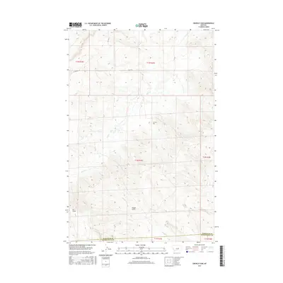
2017 Map of Crowley Dam
USGS Topo · Published 2017About this map
Crowley Dam anchors this central Montana landscape, where the high plains of Petroleum County meet the northern border of Musselshell County. The terrain is defined by its deep drainage patterns, specifically the winding courses of Alkali Cr and Howard Cr. These waterways cut through the arid topography, creating the distinct geological depressions of Howard Coulee and Jim Coulee. The sparse road network, consisting primarily of Flatwillow Rd and Kelley Rd, reflects the area's transition into remote rangeland. The map clearly delineates the complex Public Land Survey System (PLSS) grid, showing the intersection of multiple townships including t12n r27e and t13n r27e, which is essential for understanding historical land claims and modern property boundaries in this sparsely populated region.
Find a feature on this map
14 named features on this map. Tap any name to fly to it.
Don’t see what you’re looking for? This feature index may not catch every label — zoom into the map to look around manually.
Map Details
Editions of this 2017 Crowley Dam Map
This is the sole edition of this map. No revisions or reprints were ever made.
Other maps of this area

1954 · Roundup
USGS Topo · 1:250,000

1958 · Roundup
USGS Topo · 1:250,000

1963 · Kelley
USGS Topo · 1:24,000

1963 · Petrolia Lake
USGS Topo · 1:24,000

1963 · Musselshell NW
USGS Topo · 1:24,000

1986 · Flatwillow
USGS Topo · 1:24,000

1986 · Crowley Dam
USGS Topo · 1:24,000

1986 · Big Wall NW
USGS Topo · 1:24,000
1986 · Yellow Water Reservoir
USGS Topo · 1:24,000
1986 · Jim Coulee
USGS Topo · 1:24,000