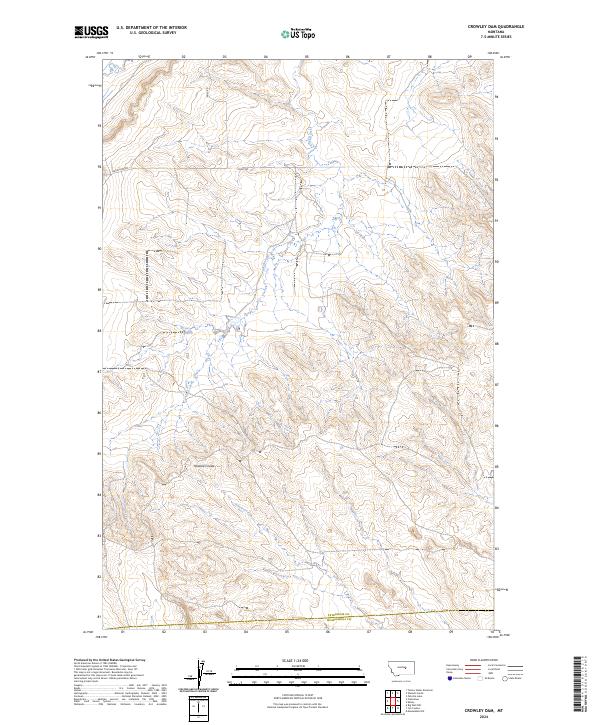
2024 Map of Crowley Dam
USGS Topo · Published 2024About this map
Alkali Creek and Howard Creek define the drainage patterns of this central Montana landscape, where the high plains meet the intricate breaks of Howard Coulee. The topography is characterized by a series of north-south ridges and drainages that reflect the arid, open ranching country typical of the region. Transportation in this area is limited to a sparse network of section-line and connector routes including Flatwillow Rd, Kelly Rd, and Kelley Rd, which provide access to remote agricultural holdings. This 2024 data captures the modern configuration of the border between Petroleum and Musselshell counties, showing how land use and boundary lines remain closely tied to the original Public Land Survey System township and range divisions.
Find a feature on this map
13 named features on this map. Tap any name to fly to it.
Don’t see what you’re looking for? This feature index may not catch every label — zoom into the map to look around manually.
Map Details
Editions of this 2024 Crowley Dam Map
This is the sole edition of this map. No revisions or reprints were ever made.
Other maps of this area

1954 · Roundup
USGS Topo · 1:250,000

1958 · Roundup
USGS Topo · 1:250,000

1963 · Kelley
USGS Topo · 1:24,000

1963 · Petrolia Lake
USGS Topo · 1:24,000

1963 · Musselshell NW
USGS Topo · 1:24,000

1986 · Flatwillow
USGS Topo · 1:24,000

1986 · Crowley Dam
USGS Topo · 1:24,000

1986 · Big Wall NW
USGS Topo · 1:24,000
1986 · Yellow Water Reservoir
USGS Topo · 1:24,000
1986 · Jim Coulee
USGS Topo · 1:24,000