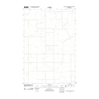
2011 Map of Crown Butte Creek NW
USGS Topo · Published 2011About this map
Bahr Creek and Scab Creek define the drainage patterns of this rural landscape in Morton County during the early 21st century. The map reveals a strictly regulated sectional grid system typical of the North Dakota prairie, where gravel roads like 61st Ave and 57th Ave follow property lines across open country. One curious deviation from the numerical grid is the short spur named Don't Dr, located just south of 47th St. Transportation through this section of the state is facilitated by regional connectors such as County Rd 87 and County Rd 137, which link isolated farmsteads and rural residences to the larger North Dakota road network.
Find a feature on this map
23 named features on this map. Tap any name to fly to it.
Don’t see what you’re looking for? This feature index may not catch every label — zoom into the map to look around manually.
Map Details
Editions of this 2011 Crown Butte Creek NW Map
This is the sole edition of this map. No revisions or reprints were ever made.
Other maps of this area

1938 · Heart Butte
USGS Topo · 1:48,000

1944 · Heart Butte
USGS Topo · 1:62,500

1954 · Bismarck
USGS Topo · 1:250,000

1958 · Bismarck
USGS Topo · 1:250,000

1960 · North Almont
USGS Topo · 1:24,000

1960 · Dengate
USGS Topo · 1:24,000

1960 · Glen Ullin
USGS Topo · 1:24,000

1960 · Heart Butte
USGS Topo · 1:24,000

1980 · Crown Butte Creek NW
USGS Topo · 1:24,000
1980 · Lake Tschida East
USGS Topo · 1:24,000