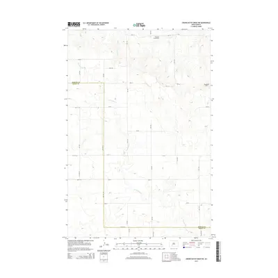
2014 Map of Crown Butte Creek NW
USGS Topo · Published 2014About this map
The rolling plains of the Missouri Plateau are defined here by the winding course of Crown Butte Cr as it snakes across the border of Morton Co and Grant Co. This section of western North Dakota remains largely agricultural, with a surveyed grid of rural roads providing access to the high ground of the Ramsland Hills in the northeast. The presence of Fitterer's Strip Airport reflects the practical necessity of private aviation for transportation and ranching operations in this open landscape. Small tributaries including Bahr Cr and Seab Cr drain the coulees, while the interestingly named Don't Dr hints at the local character of this rural road network during the early 21st century.
Find a feature on this map
28 named features on this map. Tap any name to fly to it.
Don’t see what you’re looking for? This feature index may not catch every label — zoom into the map to look around manually.
Map Details
Editions of this 2014 Crown Butte Creek NW Map
This is the sole edition of this map. No revisions or reprints were ever made.
Other maps of this area

1938 · Heart Butte
USGS Topo · 1:48,000

1944 · Heart Butte
USGS Topo · 1:62,500

1954 · Bismarck
USGS Topo · 1:250,000

1958 · Bismarck
USGS Topo · 1:250,000

1960 · North Almont
USGS Topo · 1:24,000

1960 · Dengate
USGS Topo · 1:24,000

1960 · Glen Ullin
USGS Topo · 1:24,000

1960 · Heart Butte
USGS Topo · 1:24,000

1980 · Crown Butte Creek NW
USGS Topo · 1:24,000
1980 · Lake Tschida East
USGS Topo · 1:24,000