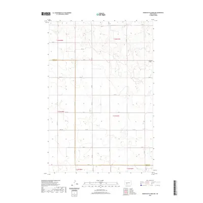
2020 Map of Crown Butte Creek NW
USGS Topo · Published 2020About this map
Ramsland Hills defines the eastern landscape of this Morton and Grant County borderland, where the terrain transitions into a network of small drainages and intermittent watercourses. The local geography is shaped by the presence of Bahr Cr and Scab Cr, reflecting the drainage patterns characteristic of the Missouri Plateau. A structured grid of section lines and gravel routes, including Co Rd 87 and Co Rd 137, provides the primary access through this sparsely settled agricultural region. The inclusion of the unique label Don't Dr indicates the specific local road nomenclature of the early 21st century. This survey documents the intersection of rural townships T138N, T137N, and T136N across the county line, offering a precise view of the land division and topography before further modern development.
Find a feature on this map
24 named features on this map. Tap any name to fly to it.
Don’t see what you’re looking for? This feature index may not catch every label — zoom into the map to look around manually.
Map Details
Editions of this 2020 Crown Butte Creek NW Map
This is the sole edition of this map. No revisions or reprints were ever made.
Other maps of this area

1938 · Heart Butte
USGS Topo · 1:48,000

1944 · Heart Butte
USGS Topo · 1:62,500

1954 · Bismarck
USGS Topo · 1:250,000

1958 · Bismarck
USGS Topo · 1:250,000

1960 · North Almont
USGS Topo · 1:24,000

1960 · Dengate
USGS Topo · 1:24,000

1960 · Glen Ullin
USGS Topo · 1:24,000

1960 · Heart Butte
USGS Topo · 1:24,000

1980 · Crown Butte Creek NW
USGS Topo · 1:24,000
1980 · Lake Tschida East
USGS Topo · 1:24,000