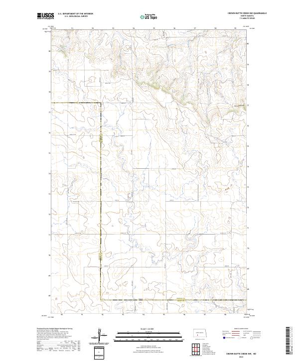
2024 Map of Crown Butte Creek NW
USGS Topo · Published 2024About this map
The rolling grasslands of the North Dakota prairie define this modern survey of the borderlands between Grant Co and Morton Co. The landscape is primarily shaped by the drainage systems of Bahr Creek and Scab Creek, which carve winding paths through the high plains. In the northeast corner, the elevation rises into the Ramsland Hills, a distinctive topographic feature overlooking a network of section-line roads such as 46th St and 53rd St. This map reflects the enduring rural character of the region, where the Public Land Survey System continues to dictate the layout of travel and property. The presence of informally named routes like Don't Dr among the standard numbered grid suggests the local scale of development in this sparsely populated area of the state.
Find a feature on this map
23 named features on this map. Tap any name to fly to it.
Don’t see what you’re looking for? This feature index may not catch every label — zoom into the map to look around manually.
Map Details
Editions of this 2024 Crown Butte Creek NW Map
This is the sole edition of this map. No revisions or reprints were ever made.
Other maps of this area

1938 · Heart Butte
USGS Topo · 1:48,000

1944 · Heart Butte
USGS Topo · 1:62,500

1954 · Bismarck
USGS Topo · 1:250,000

1958 · Bismarck
USGS Topo · 1:250,000

1960 · North Almont
USGS Topo · 1:24,000

1960 · Dengate
USGS Topo · 1:24,000

1960 · Glen Ullin
USGS Topo · 1:24,000

1960 · Heart Butte
USGS Topo · 1:24,000

1980 · Crown Butte Creek NW
USGS Topo · 1:24,000
1980 · Lake Tschida East
USGS Topo · 1:24,000