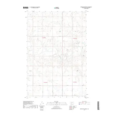
2018 Map of Crown Butte Creek SE
USGS Topo · Published 2018About this map
Crown Butte rises as a prominent landmark in this segment of Grant County, overlooking a landscape defined by the winding course of the Heart River. The terrain is characterized by the intricate drainage patterns of the northern plains, where deep-set geographic features like Pump Coulee and Cat Coulee carve through the prairie. This area shows a sparse but organized human footprint, dictated largely by the rectangular survey system. A network of rural section-line roads, including Co Rd 86, 57th St SW, and 56th Ave SW, provides access to the high plateaus and river bottomlands. The map illustrates how late 20th-century land management preserves the large-scale cattle ranching and dryland farming traditions of central North Dakota, maintaining the vast, open character of the Missouri Plateau.
Find a feature on this map
22 named features on this map. Tap any name to fly to it.
Don’t see what you’re looking for? This feature index may not catch every label — zoom into the map to look around manually.
Map Details
Editions of this 2018 Crown Butte Creek SE Map
This is the sole edition of this map. No revisions or reprints were ever made.
Other maps of this area

1954 · Bismarck
USGS Topo · 1:250,000

1958 · Bismarck
USGS Topo · 1:250,000

1980 · Otter Creek West
USGS Topo · 1:24,000

1980 · Crown Butte Creek NW
USGS Topo · 1:24,000

1980 · Crown Butte Creek SE
USGS Topo · 1:24,000

1980 · Almont East
USGS Topo · 1:24,000

1980 · Lark
USGS Topo · 1:24,000

1980 · Heil
USGS Topo · 1:24,000

1980 · Crown Butte Creek SW
USGS Topo · 1:24,000
1980 · Almont West
USGS Topo · 1:24,000