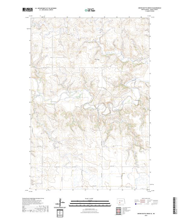
2024 Map of Crown Butte Creek SE
USGS Topo · Published 2024About this map
Heart River winds through the central portion of this Grant County landscape, defining the local drainage and topography. The river's path is joined by several dry coulees, including Pump Coulee and Cat Coulee, which carve through the high plains typical of the region. Crown Butte stands as a prominent elevation point in the northern portion of the map, serving as a landmark above the surrounding prairie. This modern survey illustrates the current section line road system, with routes such as 57th St SW and 56th Ave SW following the rigid grid of the Public Land Survey System. The map documents the persistent agricultural character of the area, where the vast majority of the terrain remains dedicated to open space and water management within the Heart River watershed.
Find a feature on this map
20 named features on this map. Tap any name to fly to it.
Don’t see what you’re looking for? This feature index may not catch every label — zoom into the map to look around manually.
Map Details
Editions of this 2024 Crown Butte Creek SE Map
This is the sole edition of this map. No revisions or reprints were ever made.
Other maps of this area

1954 · Bismarck
USGS Topo · 1:250,000

1958 · Bismarck
USGS Topo · 1:250,000

1980 · Otter Creek West
USGS Topo · 1:24,000

1980 · Crown Butte Creek NW
USGS Topo · 1:24,000

1980 · Crown Butte Creek SE
USGS Topo · 1:24,000

1980 · Almont East
USGS Topo · 1:24,000

1980 · Lark
USGS Topo · 1:24,000

1980 · Heil
USGS Topo · 1:24,000

1980 · Crown Butte Creek SW
USGS Topo · 1:24,000
1980 · Almont West
USGS Topo · 1:24,000