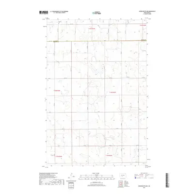
2018 Map of Crown Butte NW
USGS Topo · Published 2018About this map
Oliver Co and Morton Co are divided by a clear survey line in this part of the North Dakota prairie, where a grid of rural roads defines the movement across the landscape. The northern portion of the quadrangle features the Rosebud Cem, a quiet landmark for local genealogical research located off 35th Ave SW. This area is characterized by the headwaters and drainage of Otter Ck, which meanders through the eastern sections. The road network, including arterial routes like Co Hwy 140 and Co Rd 83, suggests a modern agricultural economy built upon the historic Public Land Survey System. The topography is marked by subtle elevation changes that direct the flow of small intermittent streams toward the larger coulees and creek beds.
Find a feature on this map
32 named features on this map. Tap any name to fly to it.
Don’t see what you’re looking for? This feature index may not catch every label — zoom into the map to look around manually.
Map Details
Editions of this 2018 Crown Butte NW Map
This is the sole edition of this map. No revisions or reprints were ever made.
Other maps of this area

1954 · Bismarck
USGS Topo · 1:250,000

1954 · McClusky
USGS Topo · 1:250,000

1958 · Bismarck
USGS Topo · 1:250,000

1958 · McClusky
USGS Topo · 1:250,000

1970 · Judson
USGS Topo · 1:24,000

1970 · New Salem NE
USGS Topo · 1:24,000

1972 · Sweet Briar
USGS Topo · 1:24,000

1972 · Center
USGS Topo · 1:24,000

1972 · Crown Butte Lake
USGS Topo · 1:24,000

1972 · Crown Butte NW
USGS Topo · 1:24,000