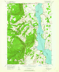
1950 Map of Crown Point
USGS Topo · Published 1961About this map
Lake Champlain serves as the focal point for this survey, marking the state boundary between New York and Vermont. On the New York shore, the Adirondack State Park dominates the landscape with prominent peaks like Bulwagga Mountain and Buck Mountain. The settlement pattern reflects a mid-century reliance on both the Delaware and Hudson railroad and traditional industry, evidenced by the Sper Mine (Inactive) on Breeds Hill. Local genealogy is well-represented through scattered institutions such as White Ch, Sacred Heart Cem, and Lake Sch.
Find a feature on this map
58 named features on this map. Tap any name to fly to it.
Don’t see what you’re looking for? This feature index may not catch every label — zoom into the map to look around manually.
Map Details
Editions of this 1950 Crown Point Map
4 editions found
Other maps of this area

1894 · Elizabethtown
USGS Topo · 1:62,500

1894 · Port Henry
USGS Topo · 1:62,500

1894 · Ticonderoga
USGS Topo · 1:62,500

1895 · Elizabethtown
USGS Topo · 1:62,500

1895 · Paradox Lake
USGS Topo · 1:62,500

1896 · Ticonderoga
USGS Topo · 1:62,500

1897 · Paradox Lake
USGS Topo · 1:62,500

1898 · Port Henry
USGS Topo · 1:62,500

1901 · Elizabethtown
USGS Topo · 1:62,500

1902 · Ticonderoga
USGS Topo · 1:62,500