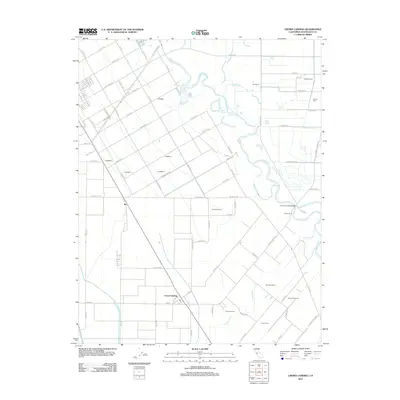
2012 Map of Crows Landing
USGS Topo · Published 2012About this map
The San Joaquin River snakes through this agricultural landscape, defining the character of the Central Valley near the community of Crows Landing. The map highlights a complex network of irrigation and water management essential to the region's dairy and farming operations, including the Delta-Mendota Canal and the Main Canal. Evidence of the local dairy industry is pervasive, with named properties such as Mendes Dairy, Amorim Dairy, and the uniquely named Moonshine Dairy scattered across the grid.
Find a feature on this map
89 named features on this map. Tap any name to fly to it.
Don’t see what you’re looking for? This feature index may not catch every label — zoom into the map to look around manually.
Map Details
Editions of this 2012 Crows Landing Map
This is the sole edition of this map. No revisions or reprints were ever made.
Other maps of this area

1915 · Westport
USGS Topo · 1:31,680

1915 · Westley
USGS Topo · 1:31,680

1916 · Mitchell School
USGS Topo · 1:31,680

1916 · Crows Landing
USGS Topo · 1:31,680

1916 · Patterson
USGS Topo · 1:31,680

1916 · Ceres
USGS Topo · 1:31,680

1917 · Newman
USGS Topo · 1:31,680

1918 · Gustine
USGS Topo · 1:31,680

1919 · Orestimba
USGS Topo · 1:62,500

1919 · Orestimba Creek
USGS Topo · 1:31,680