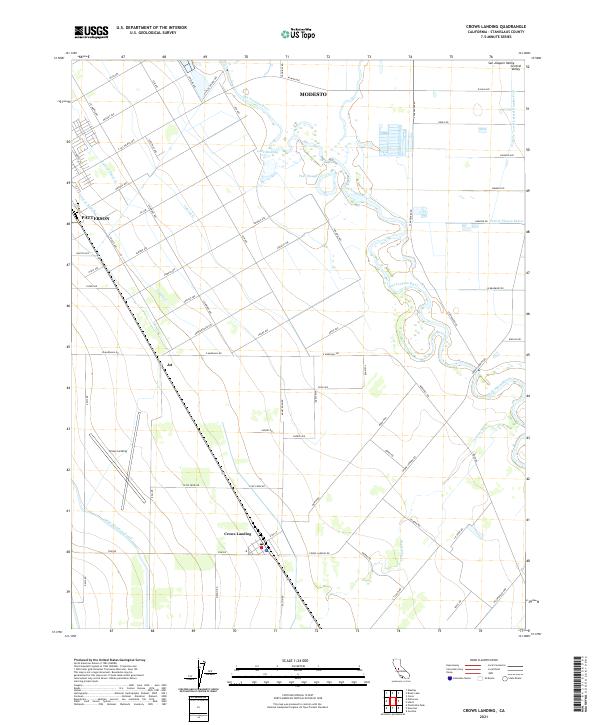
2021 Map of Crows Landing
USGS Topo · Published 2021About this map
Patterson and the surrounding agricultural lands of the San Joaquin Valley are defined by a complex irrigation network in this contemporary topographic record. The landscape is dominated by the winding course of the San Joaquin River, which is supplemented by a grid of engineered waterways including the Delta-Mendota Canal, Prairie Flower Drain, and various lateral systems like Lateral G and Lateral Three N. These features emphasize the region's intensive water management and historical reliance on river systems.
Find a feature on this map
80 named features on this map. Tap any name to fly to it.
Don’t see what you’re looking for? This feature index may not catch every label — zoom into the map to look around manually.
Map Details
Editions of this 2021 Crows Landing Map
This is the sole edition of this map. No revisions or reprints were ever made.
Other maps of this area

1915 · Westport
USGS Topo · 1:31,680

1915 · Westley
USGS Topo · 1:31,680

1916 · Mitchell School
USGS Topo · 1:31,680

1916 · Crows Landing
USGS Topo · 1:31,680

1916 · Patterson
USGS Topo · 1:31,680

1916 · Ceres
USGS Topo · 1:31,680

1917 · Newman
USGS Topo · 1:31,680

1918 · Gustine
USGS Topo · 1:31,680

1919 · Orestimba
USGS Topo · 1:62,500

1919 · Orestimba Creek
USGS Topo · 1:31,680