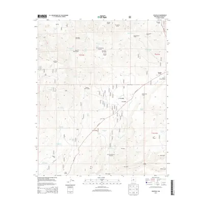
2013 Map of Cruzville
USGS Topo · Published 2013About this map
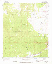
Cruzville and the nearby community of Apache Creek sit at the intersection of State Hwy 12 and State Hwy 32, serving as small outposts within the expansive Gila National Forest. The landscape is defined by the winding course of the Tularosa River and a complex network of drainage systems including Wilson Canyon and Cold Springs Canyon. This high-elevation terrain is dotted with vital water sources such as Sawmill Spring and numerous livestock tanks, including Big Flat Tank and the Alexander Tanks, which underscore the region's ranching heritage. Local landmarks like Jon S Mtn and the evocatively named Hell Hole suggest a topography that challenged early settlers and forest rangers alike. Evidence of forest management and access is visible through numerous numbered tracks and Forest Rd 41, which leads toward the settlement of Higgins Flat in the southwestern quadrant.
Find a feature on this map
104 named features on this map. Tap any name to fly to it.
Don’t see what you’re looking for? This feature index may not catch every label — zoom into the map to look around manually.
Map Details
Editions of this 2013 Cruzville Map
This is the sole edition of this map. No revisions or reprints were ever made.
Other maps of this area

1915 · Reserve
USGS Topo · 1:125,000

1918 · Reserve
USGS Topo · 1:125,000

1954 · Clifton
USGS Topo · 1:250,000

1957 · Clifton
USGS Topo · 1:250,000

1958 · Clifton
USGS Topo · 1:250,000

1962 · Clifton
USGS Topo · 1:250,000
1965 · Reserve
USGS Topo · 1:24,000
1965 · Milligan Mountain
USGS Topo · 1:24,000
1965 · Centerfire Bog
USGS Topo · 1:24,000
1965 · Aragon
USGS Topo · 1:24,000