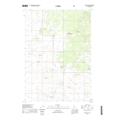
2020 Map of Crystal Butte
USGS Topo · Published 2020About this map
Targhee National Forest defines the eastern portion of this high-elevation landscape in Fremont County, where the topography is shaped by a series of prominent volcanic buttes. Centrally located, Crystal Butte and Birdseye Butte rise above the surrounding terrain, while a cluster of water bodies including Davis Lake Number One, Davis Lake Number Two, and Davis Lake Number Three sit in the northwest corner. This area, largely defined by its forest management and natural features, shows a network of service roads and tracks like Bishop Burn Rd and Fogg Butte Rd.
Find a feature on this map
29 named features on this map. Tap any name to fly to it.
Don’t see what you’re looking for? This feature index may not catch every label — zoom into the map to look around manually.
Map Details
Editions of this 2020 Crystal Butte Map
This is the sole edition of this map. No revisions or reprints were ever made.
Other maps of this area

1955 · Ashton
USGS Topo · 1:250,000

1958 · Ashton
USGS Topo · 1:250,000

1960 · Ashton
USGS Topo · 1:250,000
1965 · Split Butte
USGS Topo · 1:24,000

1965 · Blue Creek Reservoir
USGS Topo · 1:24,000
1965 · Icehouse Creek
USGS Topo · 1:24,000

1965 · Crystal Butte
USGS Topo · 1:24,000
1965 · Bishop Mountain
USGS Topo · 1:24,000

1965 · Sheridan Reservoir
USGS Topo · 1:24,000

1972 · Pine Butte
USGS Topo · 1:24,000