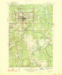
1946 Map of Crystal Falls
USGS Topo · Published 1946About this map
Crystal Falls serves as the industrial and civic anchor for this mid-1940s iron mining district. The landscape is defined by its extraction history, evidenced by specialized residential clusters like Western Location, Tobin Location, and Shafer Location that housed laborers near the shafts. Iron mining operations including the Shafer Mine and Monongahela Mine were vital to the local economy, supported by a heavy rail presence from the Chicago and Northwestern and Milwaukee St Paul and Pacific lines. Beyond the industrial sites, the area is rich with water features like the Paint River and Tobin Lake, while the Iron County Recreation Area suggests the early development of local leisure spaces. Further south, the settlement of Alpha and the Mastodon boundary indicate the spread of communities built around the region's mineral wealth.
Find a feature on this map
47 named features on this map. Tap any name to fly to it.
Don’t see what you’re looking for? This feature index may not catch every label — zoom into the map to look around manually.
Map Details
Editions of this 1946 Crystal Falls Map
2 editions found
Other maps of this area

1899 · Sagola
USGS Topo · 1:62,500

1899 · Crystal Falls
USGS Topo · 1:62,500

1939 · Iron Mountain
USGS Topo · 1:48,000

1941 · Florence
USGS Topo · 1:48,000

1941 · Iron Mountain
USGS Topo · 1:48,000

1944 · Crystal Falls
USGS Topo · 1:24,000

1944 · Fortune Lakes
USGS Topo · 1:24,000

1945 · Kelso Junction
USGS Topo · 1:24,000

1945 · Amasa
USGS Topo · 1:24,000

1946 · Crystal Falls
USGS Topo · 1:31,680