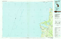
1984 Map of Crystal Lake
USGS Topo · Published 1985About this map
Sleeping Bear Dunes National Lakeshore dominates the northern shoreline of this mid-1980s Benzie County coastal survey, showcasing the dramatic transition from the waters of Lake Michigan to the interior glacial lakes. The map tracks the coastline from Sleeping Bear Point south through the harbor towns of Frankfort and Elberta. Inland, the landscape is defined by massive water bodies like Crystal Lake and Glen Lake, alongside the sprawling Pere Marquette State Forest. The settlement pattern reflects a mix of established lakeside communities and rural crossroads, with smaller locales such as Benzonia, Beulah, and the landing at Glen Haven serving as focal points. Infrastructure including the City-County Airport and the historic Lighthouse near Point Betsie underscores the area's importance for both navigation and local transit during this era.
Find a feature on this map
56 named features on this map. Tap any name to fly to it.
Don’t see what you’re looking for? This feature index may not catch every label — zoom into the map to look around manually.
Map Details
Editions of this 1984 Crystal Lake Map
2 editions found
Other maps of this area

1954 · Traverse City
USGS Topo · 1:250,000

1954 · Escanaba
USGS Topo · 1:250,000

1954 · Manitowoc
USGS Topo · 1:250,000

1955 · Cheboygan
USGS Topo · 1:250,000

1956 · Onekama
USGS Topo · 1:62,500

1956 · North Manitou
USGS Topo · 1:62,500

1956 · Bar Lake
USGS Topo · 1:62,500

1956 · Thompsonville
USGS Topo · 1:62,500

1956 · Frankfort
USGS Topo · 1:62,500

1957 · Escanaba
USGS Topo · 1:250,000