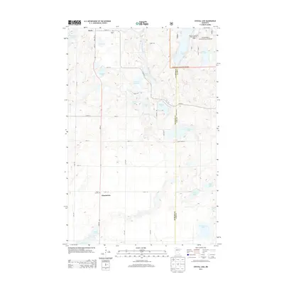
2013 Map of Crystal Lake
USGS Topo · Published 2013About this map
Akeley sits at the northern edge of this Hubbard County landscape, where the Shingobee River winds through a dense network of glacial lakes and wetlands. The transition between managed forest and rural settlement is clearly marked by the boundary of the Chippewa National Forest, which encompasses the northeastern quadrant including Howard Lake and Little Bass Lake. Local history is anchored by the Akeley Cem and White Oak Cem, while the modern recreational character of the region is evidenced by the Moore Springs Resort Lodge and RV Park. The map details a complex hydrology, from the interconnected Tenth Crow Wing Lake in the northwest to the isolated basins of Crystal Lake and N Haynes Lake further south. This 2013 survey provides a clear view of the secondary road network, such as Co Hwy-12 and State 64, which link these water bodies and scattered homesteads.
Find a feature on this map
39 named features on this map. Tap any name to fly to it.
Don’t see what you’re looking for? This feature index may not catch every label — zoom into the map to look around manually.
Map Details
Editions of this 2013 Crystal Lake Map
This is the sole edition of this map. No revisions or reprints were ever made.
Other maps of this area

1953 · Brainerd
USGS Topo · 1:250,000

1954 · Bemidji
USGS Topo · 1:250,000

1957 · Brainerd
USGS Topo · 1:250,000

1957 · Bemidji
USGS Topo · 1:250,000

1958 · Bemidji
USGS Topo · 1:250,000

1958 · Brainerd
USGS Topo · 1:250,000

1965 · Brainerd
USGS Topo · 1:250,000

1970 · Backus
USGS Topo · 1:24,000

1970 · Hackensack
USGS Topo · 1:24,000

1970 · Nevis
USGS Topo · 1:24,000