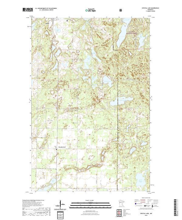
2022 Map of Crystal Lake
USGS Topo · Published 2022About this map
Akeley and Chamberlain anchor this northern Minnesota landscape, where the dense wetlands and timber of the Chippewa National Forest meet a complex network of glacial basins. The Shingobee River flows through the northern reaches near Mud Lake, while the central terrain is defined by a dense cluster of water bodies including Steel Lake, Spring Lake, and Mary Lake. This 2022 survey illustrates the modern road network, from the corridor of Co RD 49 to the more remote Frostbite Rd, which provides access to the interior woods and smaller basins like Doc Lake. Genealogists will find the locations of Akeley Cem and White Oak Cem clearly marked, serving as touchstones for local family history. The transition from established settlements to the recreational and conservation lands of the national forest is further highlighted by the presence of the Snoway 1 "Gia Snowmobile Trl" cutting through the lake country.
Find a feature on this map
61 named features on this map. Tap any name to fly to it.
Don’t see what you’re looking for? This feature index may not catch every label — zoom into the map to look around manually.
Map Details
Editions of this 2022 Crystal Lake Map
This is the sole edition of this map. No revisions or reprints were ever made.
Other maps of this area

1953 · Brainerd
USGS Topo · 1:250,000

1954 · Bemidji
USGS Topo · 1:250,000

1957 · Brainerd
USGS Topo · 1:250,000

1957 · Bemidji
USGS Topo · 1:250,000

1958 · Bemidji
USGS Topo · 1:250,000

1958 · Brainerd
USGS Topo · 1:250,000

1965 · Brainerd
USGS Topo · 1:250,000

1970 · Backus
USGS Topo · 1:24,000

1970 · Hackensack
USGS Topo · 1:24,000

1970 · Nevis
USGS Topo · 1:24,000